 Photo: Wikimedia contributors · See source
Southern Harbors & Temple Coast
Travel through Birgu, Marsaxlokk, Għar Dalam, Ħaġar Qim, Mnajdra, Blue Grotto and Dingli over two days.
- Allow
- 2 days
- Route
- 55 km
- Drive time
- 1 hr 12 min
- Stops
- 8
Across Grand Harbour, Birgu begins with fortifications and lived-in lanes. Marsaxlokk then shifts the scene to a working fishing harbor before Għar Dalam and the temple pair of Ħaġar Qim and Mnajdra place the southern coast on a far deeper timeline.
Blue Grotto and Dingli are weather stops, not guarantees. Boat trips depend on the sea, cliff paths demand distance from the edge and archaeological sites have fixed admissions. Build the route around reserved heritage time, not a chain of roadside photographs.
The road, in one glance
Pinch or scroll with Ctrl / ⌘ to zoom
Drawing the route…
The route earns
its distance
Each pin is selected as a place to do something—not merely proof that you passed through.
 Photo: Wikimedia contributors · See source
Floriana
Begin beyond the Valletta peninsula with the day’s site hours already checked.
Floriana (Maltese: Il-Furjana or Il-Floriana), also known by its title Borgo Vilhena, is a fortified town in the Port Region area of Malta, just outside the capital city Valletta. It has a population of 2,205 as of March 2014. Floriana is the birthplace of many famous Maltese, amongst which the composer of the national anthem, 'L-Innu Malti', Robert Samut; former Bishop of Malta Dun Mauro Caruana, the poets Oliver Friggieri and Maria Grech Ganado, the writer and politician Herbert Ganado and Swedish Idol winner Kevin Borg.
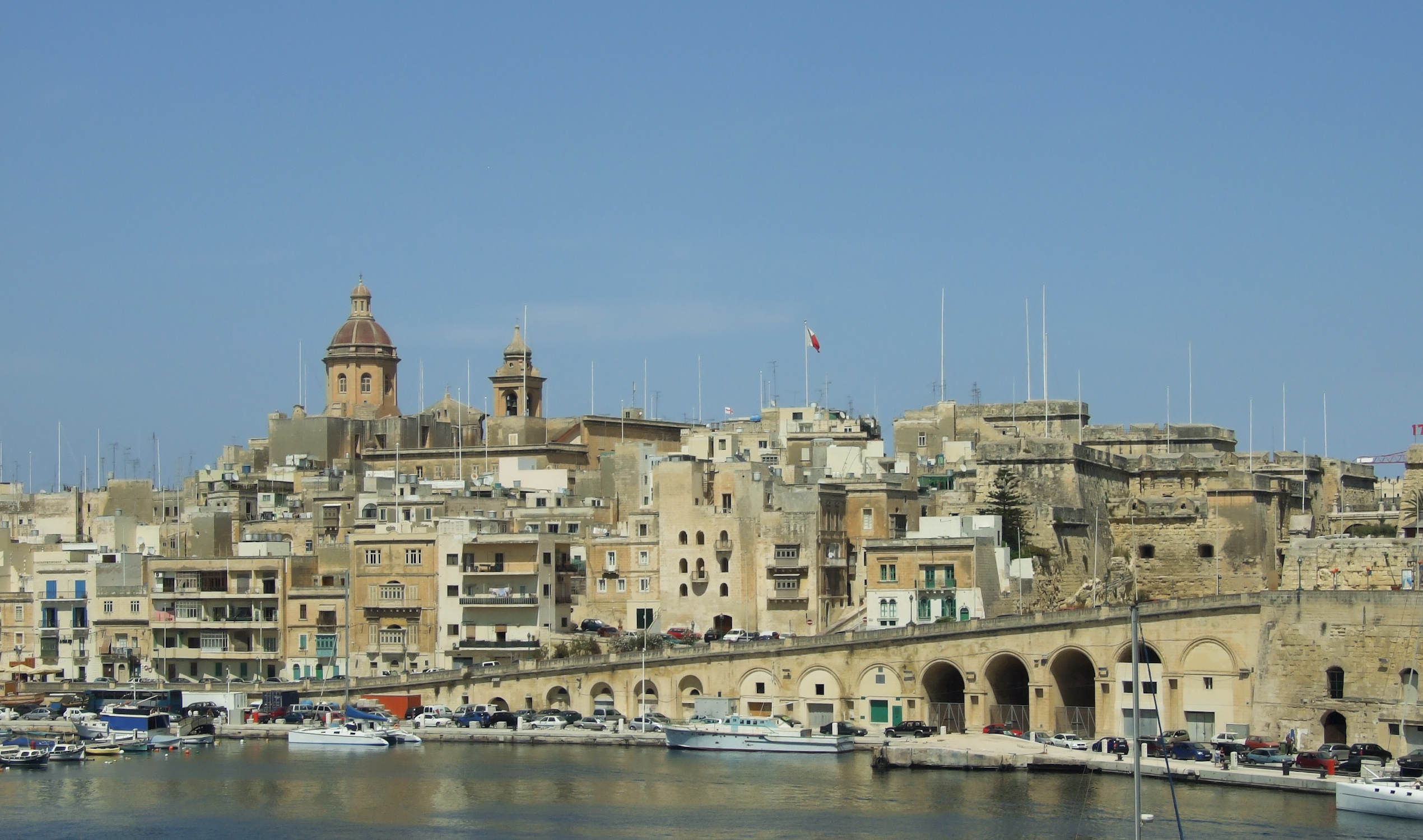 Photo: Wikimedia contributors · See source
Birgu
Fort St Angelo and a tight historic peninsula reveal the harbor from the opposite bank.
Birgu (Maltese: Il-Birgu, Italian: Vittoriosa), also known by its title Città Vittoriosa ('Victorious City'), is an old fortified city on the south side of the Grand Harbour in the Port Region of Malta. The city occupies a promontory of land with Fort Saint Angelo at its head and the city of Cospicua at its base. Birgu is ideally situated for safe anchorage, and has a long history of maritime, mercantile and military activities.
 Photo: Wikimedia contributors · See source
Marsaxlokk
Colorful working boats and a broad harbor anchor Malta’s southeast coast.
Marsaxlokk is a small, traditional fishing village in the Southern Region of Malta. It has a harbour, and is a tourist attraction known for its views, fishing and history. The village is also known for the Marsaxlokk Market, which is mainly a large fish market which takes place along the seafront on Sundays, and a tourist market during all other days of the week.
 Photo: Wikimedia contributors · See source
Għar Dalam
A cave and museum preserve evidence from Malta’s deep natural and human past.
Għar Dalam is a 144-metre long phreatic tube and cave, located in the outskirts of Birżebbuġa, Malta. The cave contains the bones of animals that lived on Malta during the Pleistocene and Holocene epochs. It has lent its name to the Għar Dalam phase in Maltese prehistory, and is viewed as one of Malta's most important national monuments.
Photo: Wikimedia contributors · See sourceĦaġar Qim
Megalithic architecture stands on a bare limestone terrace above the sea.
Ħaġar Qim is a megalithic temple complex found on the Mediterranean island of Malta, dating from the Ġgantija phase (3600–3200 BC). The Megalithic Temples of Malta are among the most ancient religious sites on Earth, described by the World Heritage Sites committee as "unique architectural masterpieces." In 1992 UNESCO recognized Ħaġar Qim and four other Maltese megalithic structures as World Heritage Sites.
 Photo: Wikimedia contributors · See source
Mnajdra
A second temple complex steps toward the coast below Ħaġar Qim.
Mnajdra (Maltese: L-Imnajdra) is a megalithic temple complex found on the southern coast of the Mediterranean island of Malta. Mnajdra is approximately 497 metres (544 yd) from the Ħaġar Qim megalithic complex. Mnajdra was built around the fourth millennium BCE; the Megalithic Temples of Malta are among the most ancient religious sites on Earth, described by the World Heritage Sites committee as "unique architectural masterpieces."
 Photo: Wikimedia contributors · See source
Blue Grotto
Sea arches and clear water cut into the southern limestone coast.
The Blue Grotto (Maltese: Taħt il-Ħnejja) refers to a number of sea caverns on the south east coast of Malta, a short distance from the fishing harbour limits of Wied iż-Żurrieq, Malta. Wied iz-Zurrieq, the Blue Grotto and neighboring caves are all located within the Qrendi village confines, per Local Council Act 1993 and a 1910 legal dispute between the villages of Qrendi and Zurrieq over their jurisdiction, which ruled in favour of Qrendi.
 Photo: Wikimedia contributors · See source
Dingli Cliffs
Malta’s high western edge catches open sea, wind and late light.
Dingli (Maltese: Ħad-Dingli) is a village in the Western Region of Malta. It is 13 kilometres (8 miles) from the capital Valletta and two kilometers (1.2 miles) from the nearest town, Rabat. The village lies on a plateau some 230 metres above sea level, near the highest point of Malta.
Drive the conditions,
not the itinerary.
Use town-edge parking, reserve heritage admissions and skip exposed coast stops in severe wind or rough seas. Harbor access roads remain working roads.
Checked against
the people who run it
Distances and driving times are planning estimates. Conditions, closures, ferries, permits and park rules can change, so check the linked official guidance before setting out.