 Photo: Wikimedia Commons contributor · See source
Gozo Two-Day Island Loop
Circle Gozo from Mġarr through Nadur, Ramla, Ġgantija, Victoria, Dwejra, Ta’ Pinu and the north-coast salt pans.
- Allow
- 2 days
- Route
- 38 km
- Drive time
- 47 min
- Stops
- 9
Gozo deserves its own roadbook rather than a rushed Malta day trip. The vehicle ferry lands at Mġarr, after which Nadur and Ramla open the eastern half, Ġgantija adds one of the islands’ great archaeological sites, and Victoria’s Citadel makes the natural overnight center.
The second day crosses to Dwejra, Ta’ Pinu and the north-coast salt pans before returning to Mġarr. Ferry schedules and queues set the outer frame; working salt pans, village lanes and rough weather set the behavior. Comino remains a boat excursion, not an improvised vehicle stop.
The road, in one glance
Pinch or scroll with Ctrl / ⌘ to zoom
Drawing the route…
The route earns
its distance
Each pin is selected as a place to do something—not merely proof that you passed through.
- 01Mġarr, Gozo
- 02Nadur
- 03Ramla Bay
- 04Ġgantija Temples
- 05Victoria & the Citadel
- 06Dwejra
- 07Ta’ Pinu
- 08Xwejni Salt Pans
- 09Marsalforn
 Photo: Wikimedia contributors · See source
Mġarr, Gozo
The vehicle ferry lands below a compact harbor and church-topped village.
Mġarr is Gozo's main harbour town and the island endpoint of the vehicle ferry from Malta. Fort Chambray, terraced streets and the church dome rise above a waterfront where ferry marshalling, fishing boats and restaurants share a compact bay.
 Photo: Wikimedia contributors · See source
Nadur
A high village opens wide views over Gozo’s eastern farmland and channel.
Nadur (Maltese: In-Nadur) is an administrative unit of Malta, located in the eastern part of the island of Gozo. Nadur is built on a plateau and is one of the largest localities in Gozo. Known as the 'second city', it spreads along a high ridge to the east of Victoria.
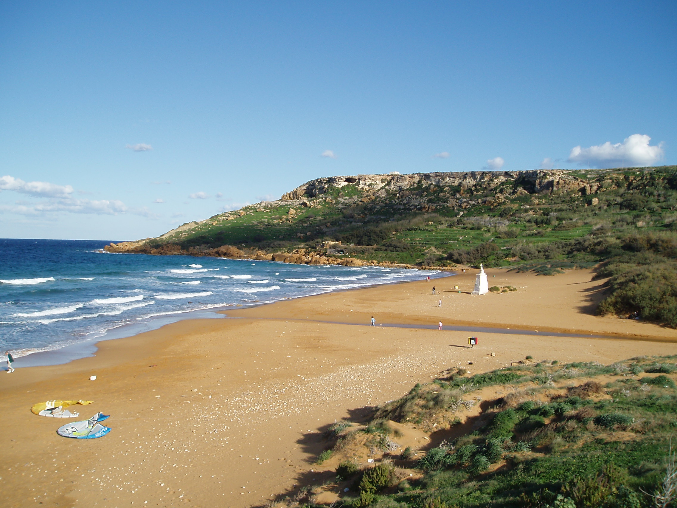 Photo: Wikimedia contributors · See source
Ramla Bay
Red-gold sand lies below terraced fields on Gozo’s north side.
Ramla Bay (Maltese: Ir-Ramla l-Ħamra, "red sands") is a bay with a beach of reddish-coloured sand in Gozo, in the Maltese Islands. It lies on the north-east coast of the island, between the bays of Marsalforn and San Blas. The closest village is Xagħra.
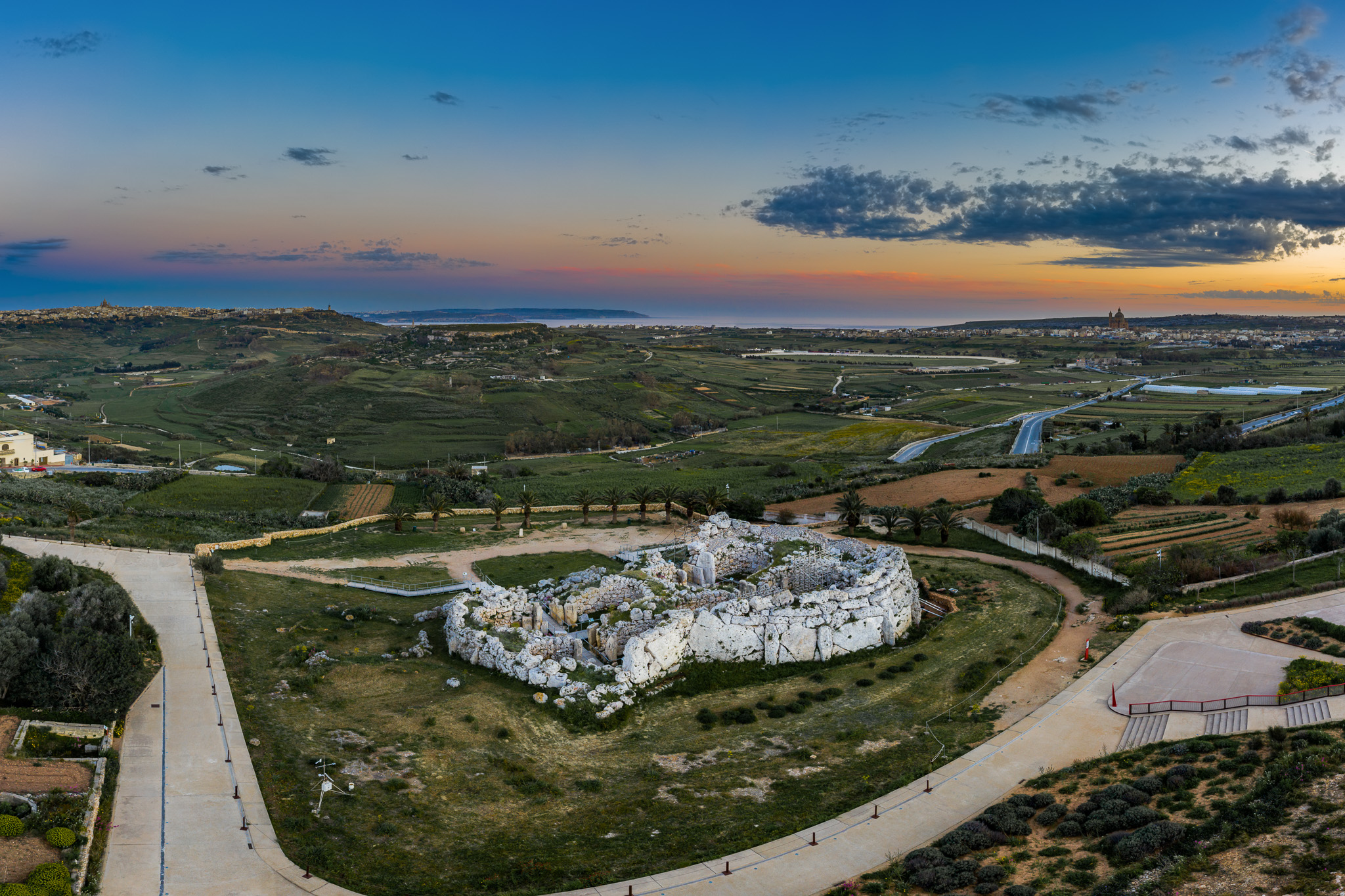 Photo: Wikimedia contributors · See source
Ġgantija Temples
Monumental Neolithic walls give the island an astonishing depth of time.
Ġgantija is a megalithic temple complex from the Neolithic era (c. 3600–2500 BC), on the Mediterranean island of Gozo in Malta. The Ġgantija temples are the earliest of the Megalithic Temples of Malta and are older than the pyramids of Egypt.
 Photo: Wikimedia contributors · See source
Victoria & the Citadel
Gozo’s capital gathers markets and lanes below a fortified acropolis.
Victoria (Maltese: Il-Belt Victoria, meaning "the city Victoria"), also known among the native Maltese as Rabat (which is the name of the old town centre) or by its title Città Victoria, is an administrative unit of Malta, and the main town on Gozo. Victoria has a total population of 6,901 (as of March 2014), and is the most populous settlement in Gozo.
Photo: Wikimedia Commons contributor · See sourceDwejra
An inland sea, fossil-rich rock and a severe western coast form Gozo’s defining landscape.
The Azure Window (Maltese: it-Tieqa Żerqa), also known as the Dwejra Window (Maltese: it-Tieqa tad-Dwejra), was a 28-metre-tall (92 ft) natural arch on the island of Gozo, located just off the shores of Malta. The limestone feature, which was in Dwejra Bay close to the Inland Sea and Fungus Rock, was one of the island's major tourist attractions until it collapsed in stormy weather on 8 March 2017.
 Photo: Wikimedia contributors · See source
Ta’ Pinu
A great basilica stands almost alone among open fields west of Għarb.
The Basilica of the National Shrine of the Blessed Virgin of Ta' Pinu (Maltese: Santwarju Bażilika tal-Madonna ta' Pinu) is a Roman Catholic minor basilica and national shrine located some 700 metres (2,300 ft) from the village of Għarb on the island of Gozo, the sister island of Malta. Pope Pius XI granted a Pontifical decree of coronation, Marianum exstat Sanctuarium towards its venerated Marian image, the Blessed Virgin of Ta' Pinu on 24 May 1935.
 Photo: Wikimedia contributors · See source
Xwejni Salt Pans
Geometric pans and low cliffs mark a working north-coast salt landscape.
Xwejni Bay (Maltese: Il-Bajja tax-Xwejni) is a bay located in the northern part of Gozo, Malta, within the limits of the village of Żebbuġ. It is used as a bathing bay and starting point for divers. The nearest place on the coast is Marsalforn.
 Photo: Wikimedia contributors · See source
Marsalforn
A sheltered bay offers an easy meal stop before the ferry road south.
Marsalforn, also written as M'Forn for shortcut purposes, is a town on the north coast of Gozo, the second largest island of the Maltese archipelago. The town lies between the hilltop towns of Xagħra and Żebbuġ. Associated with this town is the bay of Qbajjar.
Drive the conditions,
not the itinerary.
Check Gozo Channel schedules and live queues, arrive early for the vehicle ferry and use only signed public roads. Never drive onto salt pans or private farm tracks.
Checked against
the people who run it
Distances and driving times are planning estimates. Conditions, closures, ferries, permits and park rules can change, so check the linked official guidance before setting out.